

 Facebook
 X
X
 Pinterest
 Copy Link
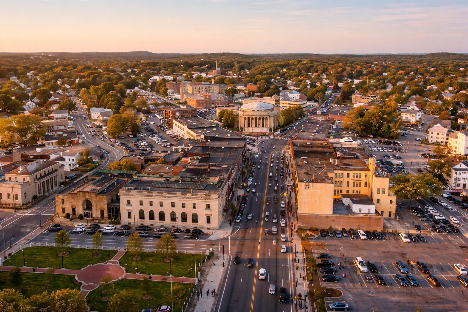
Framingham sits right in the middle of MetroWest, about 20–25 miles west of Boston, and it functions as both a regional hub and a residential city. With a population of roughly 74,000 residents as of 2025, it’s one of the larger communities outside the immediate Boston core, offering a mix of urban services and quieter residential pockets.
What stands out when you start learning more about Framingham, MA is how much ground the city covers — geographically and functionally. You’ll find a traditional downtown with commuter rail access, established neighborhoods with long-standing housing stock, newer condo developments, major retail corridors, and significant green space, all within one municipal boundary.
Framingham’s layout makes it easy to live locally while staying connected. Many daily needs — shopping, dining, parks, schools, and medical services — are within the city itself, while Route 9, the Mass Pike, and the commuter rail keep regional travel straightforward. It’s a city that continues growing and adapting, shaped by both long-time residents and newcomers relocating from around Massachusetts and beyond.
Neighborhoods & Housing Types
Framingham’s neighborhoods each have a distinct rhythm. Some areas feel bustling and urban; others are classic suburban streets with lawns and mature trees.
-
Downtown / City Center: Historically compact with older buildings, a mix of apartments and condos, and some walkable streets around Concord Street and Union Avenue. Listings here typically trend near median real estate prices for the city, appealing to people who want proximity to shops and commuter rail.
-
Coburnville & Saxonville: These areas are closer to central Framingham but still residential, with condos and single-family homes in a range of sizes; Coburnville has notable condo stock.
-
Framingham Southwest & Nobscot: More suburban in character, with larger lots and single-family homes — Nobscot’s median prices tend to be higher within the city’s housing stock.
-
West Framingham: Often shows somewhat lower list prices compared to other parts of town while still offering single-family homes and multi-unit buildings.
Housing stock across Framingham is dominated by single-family homes, which make up the bulk of owner-occupied units. Rental units are more common in the southern part of the city, and larger buildings contribute to the rental mix.
Within any given neighborhood you’ll find variations: older ranch or colonial homes on leafy streets, townhouses near transit, and occasional modern condo buildings.
 Getting Around (Driving, Transit, Bike/Walk)
City access in Framingham hinges primarily on cars, highways, and regional rail.
Driving
Route 9 cuts east–west through town and is where most people hop on for errands or head toward Natick and the Mass Pike (I-90) for longer trips. Commuter traffic peaks around typical rush hours, so allow extra time if you’re heading toward Boston or Worcester on weekdays.
Transit
The MBTA Commuter Rail serves Framingham at its downtown station with connections to Boston’s South Station via the Worcester/Framingham Line — a major plus for regional travelers. Bus routes operate locally but are less frequent than rail and often align with peak commuting patterns.
Bike/Walk
Some neighborhoods have sidewalks and bike-friendly streets; others less so. Trails like the Carol Getchell Nature Trail are popular for outdoor riding and walking.
Commute patterns from census estimates show many residents still drive alone to work, with a typical one-way commute around 30 minutes — close to or slightly above national averages.
Jobs & Local Economy
Framingham’s economy is diverse for a city its size. You’ll find:
-
Retail and services along the Route 9 corridor and at large shopping hubs.
-
Professional, scientific, and educational jobs tied to nearby educational institutions and healthcare centers.
-
Small businesses clustered in and around downtown.
MetroWest’s location between Boston and Worcester means many residents commute regionally for work, and local employers reflect a mix of established companies and startups.
Employment figures and local wage data aren’t always updated in real time on official city dashboards, but the city’s median household income sits well above many U.S. cities.
Schools & Enrollment Basics
Framingham Public Schools district serves the city. School assignments and boundaries can and do change over time, so it’s essential to check the district’s official boundary map and enrollment contact pages to confirm the school for a given address.
When researching schools:
-
Use the district’s official site to verify grades served, contact information, and enrollment procedures.
-
Many third-party sites report test scores, class sizes, and state accountability data — treat those as supplemental and verify with official state/district reports.
This section is about understanding system basics, not ranking or judging quality. Boundaries can change each year, and what’s true for one neighborhood today might shift before the next fall semester.
Parks, Trails & Things to Do
Framingham has more than just a Main Street. People who enjoy the outdoor side of a community can find:
-
Carol Getchell Nature Trail — newly connected sections are complete and make for easy walking or biking.
-
Farm Pond & Cushing Memorial Park — water and green space in northern parts of the city.
-
Local fields, playgrounds, and community gardens — maintained by the Parks & Recreation Department.
Community events, farmers markets, arts activities, and local festivals are scattered through the calendar year and often listed on the city’s official community calendar.
Cost of Living & Typical Housing Costs
If you’re budgeting for moving to Framingham, MA, it’s helpful to place local costs in context.
-
Overall cost of living is well above the national average — by approximately 35–37% depending on the calculator you use.
-
Housing is the primary driver: typical home values and rents exceed national norms. For example:
-
Median listing home prices have hovered near or above $650,000 in recent trends.
-
Condos and smaller units can range widely, with studio/1-bed options visible on listings from around $160,000 upward depending on size and location.
-
-
The median home value per Census/Others sits above $600,000, roughly twice the U.S. median value.
Renters should expect rents above national medians as well; local rental databases show wide variance by unit size and neighborhood.
Utility, transportation, and grocery costs also trend above U.S. averages, though sometimes less dramatically than housing costs.
How to Research Zoning, Permits & Property Records
If you’re buying single-family homes, condos, or exploring development:
-
The City of Framingham’s Zoning and Land Use pages list the current zoning map and permitted uses by district. These are the official references for what’s allowed on any parcel.
-
For building or renovation, the city’s permit office handles applications. Instructions, fees, and submission portals are all found on the city website.
-
Assessor and property records are available through the city’s online databases. You can look up parcel details, tax history, and lot size before offers or renovations.
A quick tip: always verify zoning and permitting requirements before writing an offer if your plans include major changes to the property.
Public Safety Data: How to Find & Read the Official Dashboards
Framingham’s police department and city government’s websites provide official crime and public safety data.
Here’s how to approach it without making subjective judgments:
-
Visit the city’s public safety or police page on the official city website.
-
Look for crime dashboards or monthly statistics — these often show offenses by type and timeframe.
-
Note that raw numbers say little without context of population size and time span; comparing year-over-year trends gives you a more stable picture than single snapshots.
Reliable interpretation comes from the source itself, not third-party summaries. Always check datetags on any dashboard you use.
FAQs
: How does the housing market in Framingham compare to the national average?
Housing prices and rents in Framingham are above national averages; median home values here tend to exceed U.S. medians by a notable margin, reflecting its proximity to Boston and regional demand.
: What types of housing are most common here?
Single-family homes make up most owner-occupied housing, while rental stock includes apartments in multi-unit buildings and some condo complexes.
: Is public transit widely available?
Framingham has a commuter rail station with service toward Boston and Worcester, with more limited local bus service; most residents still drive.
: Where can I check school assignments for an address?
Use the Framingham Public Schools official site or boundary maps provided there; boundaries are updated periodically and are your best source for current assignments.
: How can I find official zoning rules for a property?
The City’s Land Use & Zoning page lists zoning districts and what uses are permitted; check the zoning designation for an address before finalizing any plans.
Sources
-
City of Framingham Official Website – zoning, planning, permits
-
Framingham, MA Housing Market – Realtor.com – median prices & trends
-
Data USA – Framingham Profile – population, housing values
-
Payscale & Salary.com – Cost of Living Comparisons
-
Framingham Public Schools official site – enrollment info
-
Local parks & trails news – city project updates


